GEOLOGY RESEARCH
INSTAR Lab approaches geology as both a foundational Earth science and a data-intensive discipline reshaped by remote sensing, machine learning, and high-performance computing. We investigate tectonic processes, volcanic systems, sedimentary archives, and critical mineral deposits — domains where fundamental scientific understanding intersects directly with national security, infrastructure resilience, and resource independence. Geological insight also informs adjacent fields: past climate records locked in sediment cores, for instance, constrain the models we use to project future change.
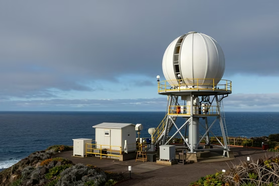
Cascadia Subduction Zone Monitoring
Seismic hazard along major subduction zones represents one of the most consequential unsolved problems in applied geophysics. We are interested in how continuous geodetic and seismic monitoring — combined with machine-learning analysis of tremor and slow-slip signals — can sharpen probabilistic hazard models that directly inform infrastructure design and emergency preparedness policy.
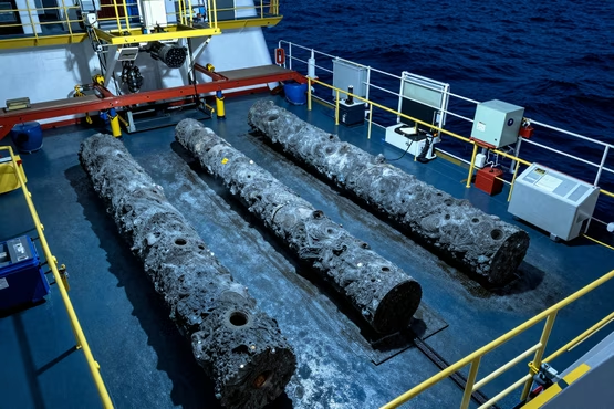
Deep Ocean Core Sampling
Deep ocean sediment and rock cores preserve an exceptionally detailed archive of past climate states, ocean chemistry, and biological turnover. We are interested in how high-resolution core analysis — isotopic proxies, biomarkers, micropaleontology — can extend climate reconstructions beyond instrumental records and constrain the sensitivity of Earth's climate system to forcing.
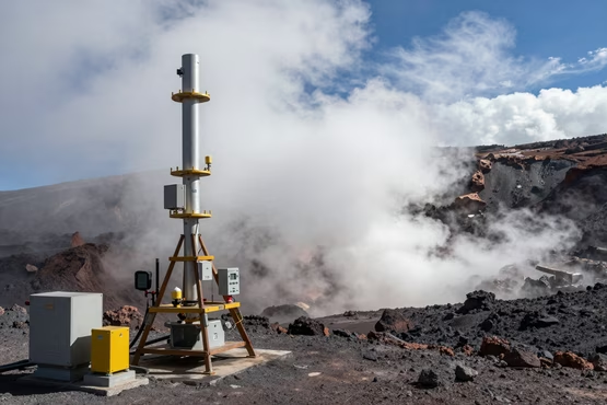
Volcanic Gas Geochemistry
Volcanic eruptions remain among the most difficult natural events to forecast reliably. We investigate how continuous multi-parameter monitoring — volcanic gas flux, ground deformation, seismicity, and thermal imaging — can be synthesized using data-driven methods to improve eruption warning lead times for at-risk communities and aviation authorities.
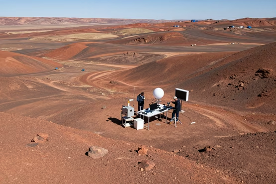
Planetary Geology Analog Studies
Terrestrial analogs of Martian and lunar geology — arid volcanic fields, impact craters, hypersaline lakes — provide test environments for calibrating remote sensing instruments and validating interpretive frameworks before they are applied to planetary datasets. This work sits at the productive boundary of Earth science and space exploration, reinforcing INSTAR's commitment to research that crosses disciplinary lines.
GROUNDED IN OPEN DATA
INSTAR Lab grounds its geology research in transparent, publicly available datasets for reproducibility and public accountability. We draw on federal geological survey data, seismic monitoring networks, and national mapping programs to support rigorous, field-verifiable Earth science.
USGS
Comprehensive geological, hydrological, and geospatial datasets from the U.S. Geological Survey underpinning our Earth systems and mineral resource research.
USGS Earthquake Hazards
Real-time and historical seismic data used in our geophysical hazard modeling and subsurface dynamics research.
The National Map
High-resolution topographic, hydrographic, and land-cover data from USGS supporting our remote sensing and geospatial analysis work.
data.gov
Federal open-data portal providing USGS, USDA, and EPA datasets for integrated environmental and geological research.
OUR PARTNERS

For Researchers
Join the INSTAR Fellowship
The INSTAR Fellowship is an open citizen-scientist program — no minimum degree required, selection based on fit with our research culture. Structured mentorship, interdisciplinary scope, and the freedom to pursue hard problems.